


U.S.: First storm hits California, more heavy rain due following week


The first of the California winter storms forecasted to hit in May struck the northern part of San Joaquin Valley on Thursday, affecting Sacramento and Stockton the most with 1.5" and 1" (3.8cm and 2.5cm) of rainfall respectively.


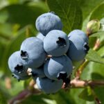
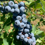
Crop damage has been a concern as these regions are big suppliers of cherries and blueberries this time of year, reports weather-tracking company Weathermelon.
At the southern end of the valley, rain totals in Bakersfield and Fresno were much less - under .1” (.25cm). Meanwhile, in the strawberry and lettuce-growing regions along the coast, Salinas received .5” and Santa Maria received .25”.
Round two of this month's storms is expected to hit on Saturday, bringing with it another .75” of rain to the Sacramento area and to the coastal regions.
The southern end of the San Joaquin Valley should be less affected, with Weathermelon predicting it to receive approximately .25”.
However, Weathermelon cautions there's the possibility of more rainfall next Tuesday and another potential storm on Friday, May 24.
Besides the rain, these storms are also bringing cooler weather to the regions.
Bakersfield typically has temperatures in the 90°s ( above 32°C) this time of year but yesterday had a high of only 67°F (19°C). This region won’t see maximum temperatures rising to the mid-70°s until next Saturday 25.
At the same time, Sacramento had a maximum temperature of 58°F yesterday - 30°F below normal for this period.
Along with current harvests, these cooler temps could potentially affect summer crops from these regions, such as bell peppers, melons, grapes, etc.
The company notes that time will tell whether harvest start dates for these categories get pushed back.
Cooler temperatures have also affected desert growing regions, where summer crops are already starting to harvest.
The Imperial Valley of California will experience maximum temperatures in the upper 70°s and lower 80°s for the next 10 days. This region should be in the mid 90°s heading into the second half of May, predicts Weathermelon.
This could cause a "slow down" in crops from these regions, it adds.
While California suffers these storms, the company calls Georgia's weather "perfect", with Georgia's high temperatures currently in the low 90°s.
Still, The Peach State is forecasted to experience a heat wave by next weekend.
Starting Monday, temperatures will begin to rise slightly every day. By Friday 24 the region will above the 100°F (about 38°C) mark - these temperatures will likely persist for several days.
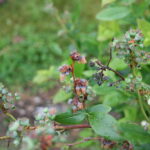
This same heat wave is expected to extend north into the Carolinas, possibly increasing the states' volume of blueberries.
In contrast, Yakima and Wenatchee Valleys in Washington state are experiencing some rain and cooler temps. Yesterday the valleys received somewhere between .25-.75” (.63-1.9cm) of rain.
The unseasonably cooler temperatures and rain have affected Hood River, Oregon, as well - another big region for cherries. The area is set to receive daily rain over next five days with maximum temperatures in the 50°s (above 10°C). The normal high temperature for this time of year is 72° (22°C).
With this wet and cooler weather, Weathermelon notes that it could be an interesting season for cherries all the way through the summer.


Subscribe to our newsletter